Climate Change in Australia
Climate information, projections, tools and data
About Southern and South Western Flatlands
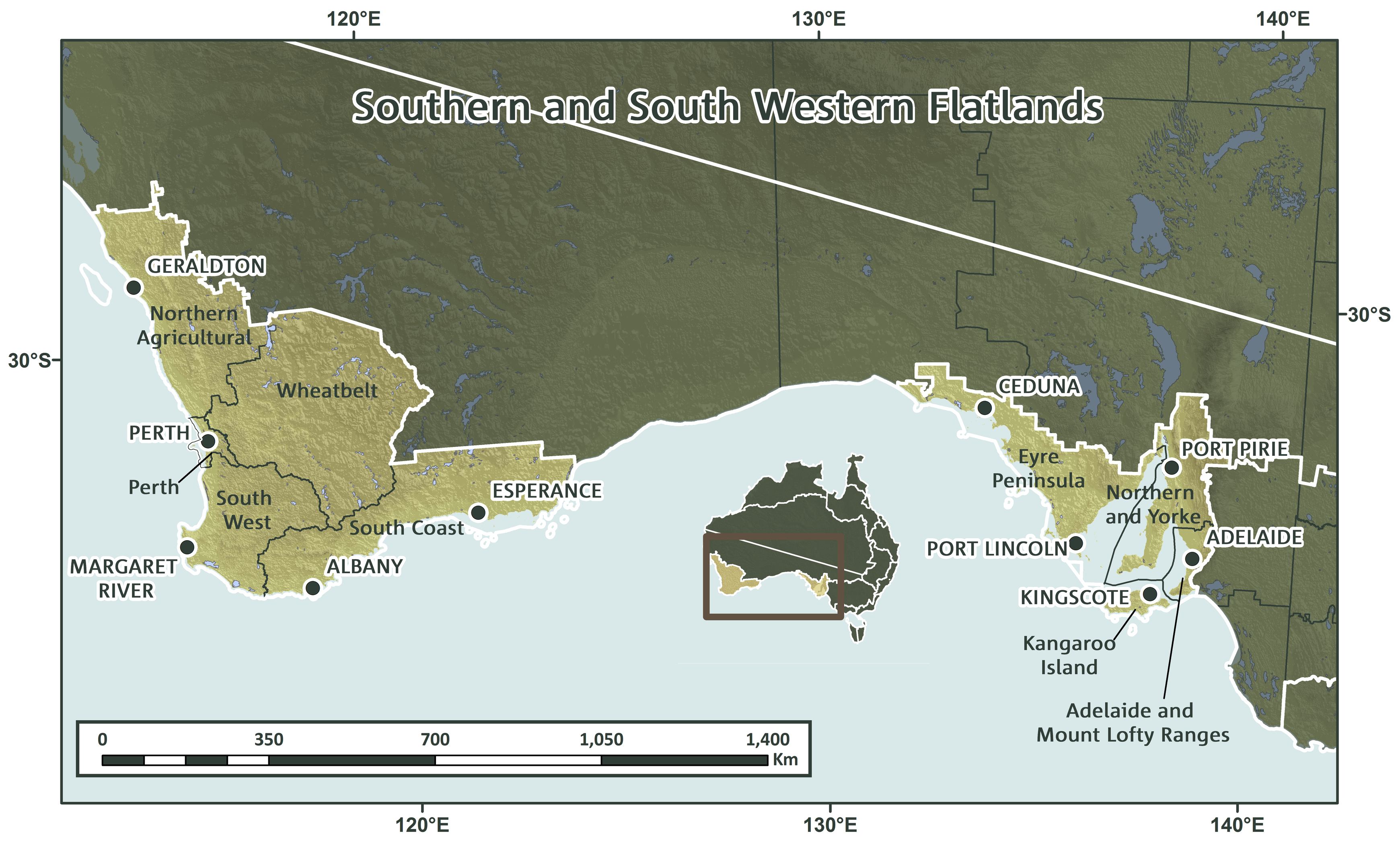
The Southern and southwestern Flatlands cluster covers approximately 754,000 km2 and includes two geographically distinct regions, the Southern and South Western Flatlands West (SSWFW) sub-cluster located in Western Australia, and the Southern and South Western Flatlands East (SSWFE) sub-cluster located in South Australia. Together these two sub-clusters incorporate nine NRM regions: South Coast, South West, Perth, Wheatbelt and Northern Agricultural in the SSWFW sub-cluster, and Eyre Peninsula, Kangaroo Island, Adelaide and Mount Lofty Ranges, and Northern and Yorke in the SSWFE sub-cluster. Both sub-clusters have extensive coastlines. The SSWFW sub-cluster coincides with a globally recognised biodiversity hotspot, defined by high levels of plant diversity and endemism, coupled with significant landscape modification. Orographic features of note in this cluster include the Stirling and Porongurup Ranges, Darling Scarp and Mt Lofty Ranges. Most of this region is characterised by a Mediterranean-type climate, with warm, dry summers and cooler, wetter winters.
Key Messages & Issues
The Flatlands cluster encompasses one of the five Mediterranean ecosystems that occur globally. These five areas support 20% of the Earth’s known vascular plant diversity. High levels of conversion for agriculture, development and other human uses have resulted in these areas being considered a global conservation priority. Increasing temperatures and decreasing rainfall associated with future climate change is expected to further threaten biodiversity in the Australian Mediterranean ecosystem. The NRM regions across the cluster are working with researchers to identify how threats to biodiversity and agriculture from climate change can be mitigated.
Background to Research
This project consists of four sub-projects:
- Review and synthesis of existing information
- Preparation of spatial data layers based on existing studies
- New bioclimatic modelling
- Ongoing support for planning using spatial data
The project commenced with workshops in Perth and Adelaide in 2013 aimed at identifying data priorities of the NRM regional organisations in the cluster and clarifying which planning tools would be used by the NRM regions to incorporate climate change into NRM planning. On-going consultation following these workshops led to the identification of key biodiversity and agriculture data needs that included threatened species and their habitats, key and/or iconic flora species, key vegetation habitat types, linkages and corridors and fire.